Use in dyke construction reinforcement
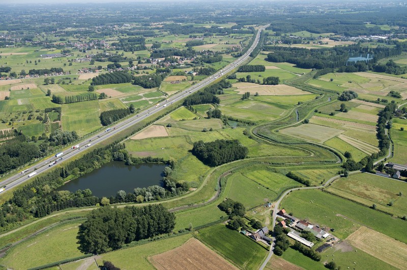
Within the framework of the Flemish flood protection program Sigmaplan for the river Scheldt estuary, De Vlaamse Waterweg (The Flemish Waterways, the Flemish agency responsible for the control of around 1000 km navigable waterways in Flanders) plans to renovate the Controlled Flood Area “Potpolder IV“. The renovation of the historical Potpolder IV along the Durme river, a Scheldt tributary, involves the construction of a new ring dyke (length 3600 m) and the reprofiling of the existing dyke along the river into an overflow dyke over 2260 m. Dredged material from the Durme river will be used as building material for the construction of new embankments. The project is a pilot within the Interreg 2 Seas program “Using Sediments as A Resource“, USAR.
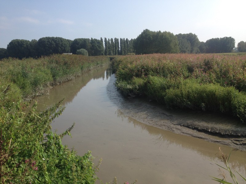
Based on the investigation report (2018), the sediments in the Durme river contain increased levels of heavy metals, TPH, PFAS, PAH and PCB (exceed the levels for free use VLAREBO Annex V). The concentrations of some heavy metals and TPH exceed the levels of non-moulded building materials (VLAREMA). Furthermore the granulometry of the sediments (silty clay to sand) gives a geotechnical challenge for reuse in the dykes. The dredged material will be treated before use in the new dyke bodies. The dredging strategy and mobile treatment plant setup will be organized in order to obtain the VLAREMA certificate, to fulfil the requirements of minimal transport and to fulfil the geotechnical stability requirements of the new dyke bodies. The reuse is evaluated based on environmental and geotechnical criteria.
In March 2018 the tender documents for the dredging works will be published. Maximum reuse of dredged sediments into the dyke bodies is requested. The selected contractor will be obligated to start with a feasibility study for the geotechnical, environmental and juridical aspects. The dredging works at the Durme River will start in 2019 and have a duration of approximately three years. As a result the river profile will be modified, nature will be restored at the river banks, and no dredged material has to be removed from the area.
Graphical information:
References/web links
- USAR webpage: https://www.vlaamsewaterweg.be/usar
- VLAREMA - 17 FEBRUARY 2012. - Order of the Government of Flanders adopting the Flemish regulation on the sustainable management of material cycles and waste
- VLAREBO - Decree on soil remediation and soil protection. DECREE of 27 octobre 2006 on soil remediation and soil protection
- Flemish flood protection programme SIGMAPLAN http://sigmaplan.be/nl/projecten/durmevallei/
- Investigation report Beneden-Durme. Witteveen+Bos (2018)